Garmin inReach Mini GPS SOS tracker
Last items in stock
The latest Iridium tracking and communication device, with offline tracking data
Share your expedition route with your family and friends via SMS, EMail, Twitter, Facebock and MapShare.
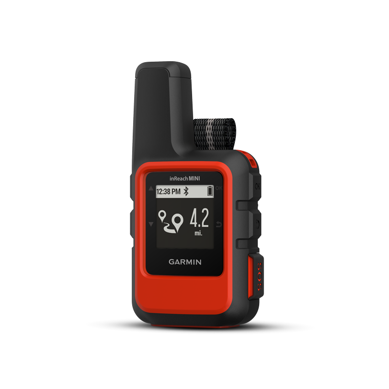
The Garmin inReach Mini is a compact, rugged satellite communications device for two-way text messaging with 100% worldwide Iridium coverage.
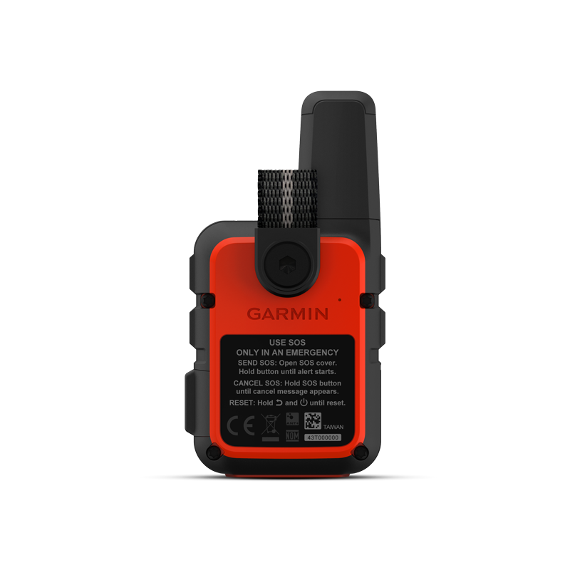
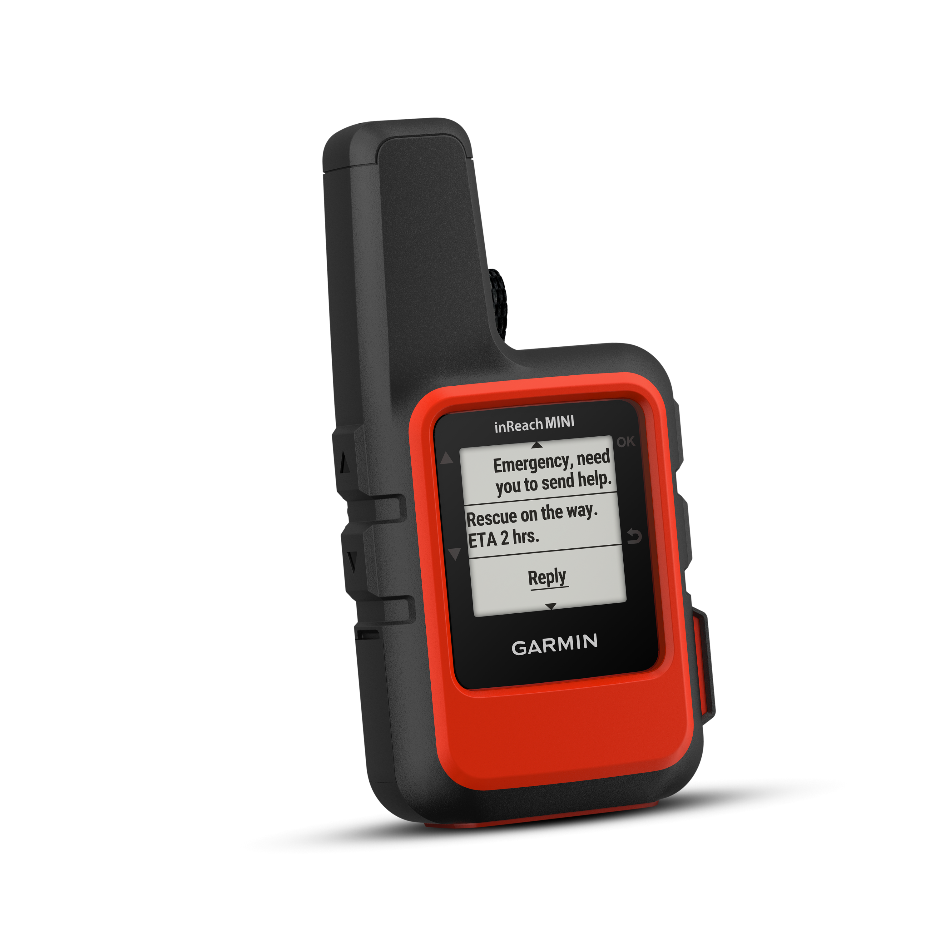
With Garmin inReach Mini, you can send and receive inReach messages via compatible Garmin devices such as connected wearables and handheld devices. Additionally, 3 different PRESET messages can be sent to up to 10 preset recipients using only 1 data unit. The Garmin inReach Mini features an interactive SOS emergency call to a 24/7 emergency monitoring center.
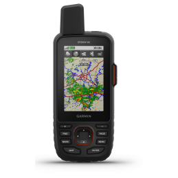
With the satellite communication device, Bluetooth pairing to iPhones and Anroid smartphones (Android 2.2. and above) is possible for additional functions. The Garmin Earthmate app also gives you access to downloadable maps and full-color aerial photos.
The global satellite communication device in pocket format
Reachable worldwide even without a wireless network. Write and receive messages, follow a route, track your adventure and share your hiking, climbing or hunting trip with others.
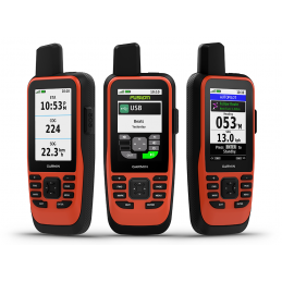
Size and weight matter on your next adventure?
Travel lighter, communicate smarter
Measuring just 9.9 x 5.2 cm and weighing just 100 g, the Garmin inReach Mini fits comfortably in your pocket or backpack. The Garmin inReach Mini enables messaging over the Iridium satellite network with seamless 100% coverage worldwide. So you no longer have to worry about dead spots, roaming charges or mobile network availability. With Garmin inReach Mini, you can send and receive SMS messages, track and share your trip, and if necessary, make an SOS emergency call to the 24/7 GEOS emergency call center anywhere in the world.
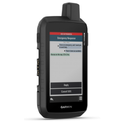
GEOS Alliance
GEOS is a leading provider of emergency response solutions and monitoring. The company has helped save many lives in rescue operations in over 140 countries. The center is staffed 24/7 throughout the year to respond to your SOS emergency call, locate your device and notify the appropriate contacts and emergency services in your area. Once you place an emergency call, you'll receive confirmation that help is on the way and continuous updates on the status of the rescue mission.
Weather data worldwide
The optional inReach weather service provides detailed updates on the Garmin inReach Mini or compatible device paired with the Earthmate app to keep you well informed about weather conditions. There are basic and premium weather data to choose from. You can request weather forecasts for the current location or for another waypoint or destination on the route.
Battery & Device Information
Rugged, tough, shockproof (MIL-STD-810F) and waterproof to IPX 7, the inReach Mini is always at your side. It features a lithium-ion battery with up to 90 hours of runtime in standard mode with 10-minute tracking and up to 20 days of runtime in power-saving mode. Charge the device with the microUSB cable or the optional 12V charger.
Various connectivity options
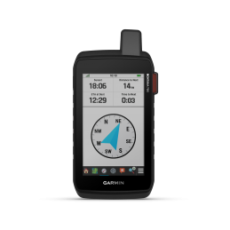
Send and receive messages via compatible Garmin handhelds, wearables or other mobile devices. The Garmin inReach Mini has a compass that shows bearing and distance along a route or to a waypoint. You can also post your adventures to social media.
Pairing with your mobile device
The free Earthmate app opens up additional possibilities. It syncs the Garmin inReach Mini with your compatible Apple or Android device via Bluetooth, giving you a wealth of maps and aerial imagery at your fingertips. Earthmate also lets you use all the inReach features on your mobile device. You can also access the contact list on your phone through the Earthmate app, making it even easier and faster to send messages around the world.
Pairing with Garmin Pilot
In aviation, the Garmin inReach Mini is an important communication tool. Pair it via Bluetooth with a compatible tablet or smartphone running the Garmin Pilot app, and you can easily send or receive text messages from the cockpit even in regions without cellular signal. The app uses your device's contact list, making access easy and seamless. As a handheld GPS device, Garmin Pilot can also access the inReach Mini as a reliable position source, so your aircraft's position can be reflected as an icon on your tablet's moving map display thanks to georeferencing. For those tracking your position from the ground, the Garmin inReach Mini also offers the ability to track your flight position via the web-based MapShare page created for your inReach account. You can also connect your connection via Facebook or Twitter.
Other aviation services
Your Garmin inReach Mini is also supported by Leidos Flight Services (LFS) Adverse Condition Alerting Service (ACAS), Surveillance-Enhanced Search and Rescue (SE-SAR) and Enhanced Special Reporting Services (eSRS). When you register for ACAS information, alerts provided by LMFS will briefly inform you of adverse weather conditions that could affect your planned flight path. Automatic monitoring of SE-SAR enables the system to detect potential in-flight emergency situations and/or signals to initiate search and rescue operations for your aircraft.
Flexible tariffs
An active subscription to satellite services is required to access the Iridium network and communicate with the inReach Mini. Depending on usage, you can sign an annual contract or opt for flexible, free contracts on a monthly basis.
Includes unlimited cloud storage and route planning
Along with the Garmin inReach Mini, you get free access to a cloud-based portal. There you can plan trips with routes and waypoints, create message templates and instant messages, sync and manage device settings, update firmware, link to social network accounts, store all position tracking data and much more.

Specific References
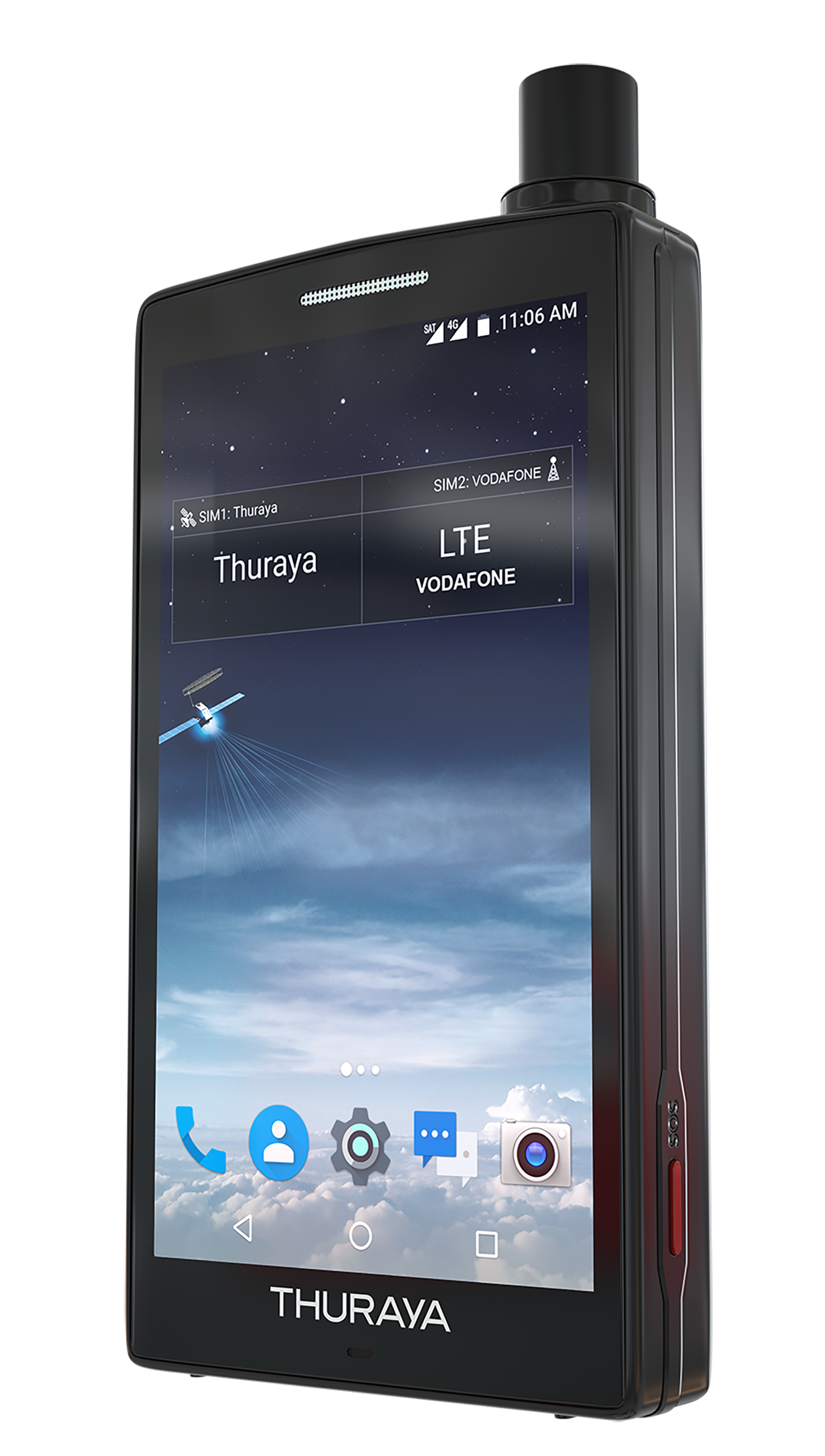
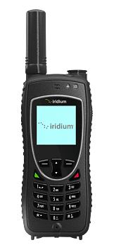
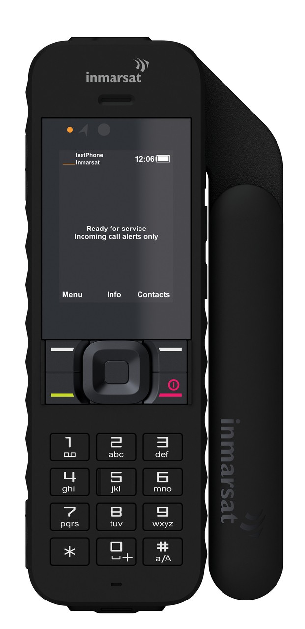
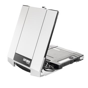
Related products
The latest Iridium tracking and communication device, with offline tracking data
Share your expedition route with your family and friends via SMS, EMail, Twitter, Facebock and MapShare.
The Garmin inReach Mini is a compact, rugged satellite communications device for two-way text messaging with 100% worldwide Iridium coverage.
With Garmin inReach Mini, you can send and receive inReach messages via compatible Garmin devices such as connected wearables and handheld devices. Additionally, 3 different PRESET messages can be sent to up to 10 preset recipients using only 1 data unit. The Garmin inReach Mini features an interactive SOS emergency call to a 24/7 emergency monitoring center.
With the satellite communication device, Bluetooth pairing to iPhones and Anroid smartphones (Android 2.2. and above) is possible for additional functions. The Garmin Earthmate app also gives you access to downloadable maps and full-color aerial photos.